Historic Preservation Digital Twins
Preserve History in Immersive Detail
Historical Property Preservation With Digital Twins and As-Built Documentation
Welcome to Scena’s resource for historic preservation in Georgia. Our services use advanced 3D scanning technology to create detailed digital twins and as-built models, supporting the stewardship of Georgia’s landmarks through precise documentation, collaboration, and innovative applications. Whether you’re a donor committed to history or a professional architect, engineer, or designer, our tools emphasize accuracy, accessibility, and partnership to extend the life of historic sites.
Digital Twins: Capturing History in Immersive Detail
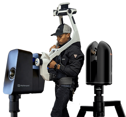
Our digital twins are created via advanced 3D scanning that combines high-resolution 360° imagery with LiDAR for millimeter-level accuracy. Starting with a non-invasive onsite scan, we produce a cloud-based, interactive 3D model explorable from any device, allowing virtual navigation, measurements, and annotations.
As the official virtual tour provider for The New American Home (TNAH) and The New American Remodel (TNAR) at the International Builders’ Show for the past 11 years, we deliver exceptionally polished, professional-grade tours that highlight intricate details and enhance user experiences.
Historic Preservation Digital Twin Services
Virtual tours with tags for features, artifacts, or stories to engage schools and the public remotely.
Scout spaces virtually while respecting site integrity.
Share with fire departments and others for virtual training of environments.
Immersive experiences showcasing restoration progress to build support and funding.
Annotate with maintenance schedules and inventories for proactive upkeep of historic elements.
Detailed records for claims, including measurements and materials, to ensure accurate reconstructions.
Share with experts for restoration input, reducing travel.
Tamper-proof archives for studying architectural evolution and material changes.
Virtual access for those with mobility issues, promoting inclusivity.
As-Built Services: Collaborating with Architects, Engineers, and Designers
For design professionals in historic renovations, our as-built services deliver high-accuracy data from LiDAR-enhanced scans, providing foundational references without claiming surveying or architectural expertise. We partner with architects, engineers, and designers to supply 3D models and 2D deliverables for your certified plans and workflows. Explore our dedicated services page for more.
Renovation Planning
Detailed models capturing geometries and elements for design iterations preserving original features.
BIM Integration
Convert data to formats like Revit for clash detection in structural or MEP assessments.
Elevation Views
Reference sections for facade restorations, under your professional oversight.
Tax Credit Support
Accurate measurements for Georgia’s Historic Rehabilitation Tax Credit applications. Click learn more. Full text of bill.
MEP Mapping
Visualize systems to avoid conflicts in upgrades like fire suppression.
Space Planning
Site captures for adaptive reuses respecting heritage guidelines.
Disclaimer: Scena provides 3D scanning and as-built documentation for visualization, planning, and design coordination purposes. Our deliverables are not certified surveys or permit-ready architectural drawings, which can only be performed or approved by a licensed professional. While our technology is capable of collecting data at survey-grade tolerances, Scena is not a licensed surveying firm. If certified documents are required, we are happy to you in contact with a professional who can help.
Frequently Asked Questions
We operate 11 field offices across the U.S. and have the capability to mobilize and travel for larger projects. Our network of local contractors ensures comprehensive nationwide coverage, allowing us to efficiently deliver services anywhere in the country.
Our team utilizes high-resolution 3D LiDAR scanning, NavVis SLAM technology, and Matterport imaging to capture your space with extreme precision.
We deliver CAD files (DWG, DXF), BIM models (Revit, IFC), SketchUp, PDFs, and cloud-based digital twins based on your project needs. We can convert into almost any 3d file type.
Our files are compatible with AutoCAD, Revit, SketchUp, and other industry-standard platforms for seamless integration into your workflow.
Deliverables are for design reference only and are not certified as-built surveys or architectural record drawings. Final submission for permitting must be prepared or approved by a licensed professional. We can help you find one if needed. Contact Us.
Yes, we offer both 2D as-built drawings and fully interactive 3D models, allowing you to visualize and analyze your space in different formats.
Accuracy depends on the clients needs and budget. Our LiDAR and 3D scanning technology can capture survey grade data if necessary, ensuring the highest level of detail for architectural, engineering, and facility management applications. A licensed surveyor must review and signoff as we are not surveyors.
Yes, we provide updates and revisions to ensure your as-built documentation stays current with any modifications or renovations.
NavVis and SLAM-based technology, we can scan large spaces quickly and efficiently, significantly reducing the time compared to traditional static LiDAR scanning.